Mana Village Travel Guide (Updated 2026): My Bheem Pul and Food Stops
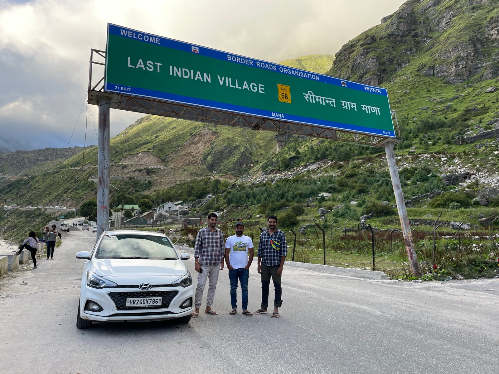
I reached Mana by car with two friends and stopped under the large Border Roads Organisation sign that called it the “Last Indian Village.” The green slopes, grey rock and cold mountain air made the border-road setting feel immediate. A slogan has since promoted Mana as India’s “first village,” but neither phrase tells you what the visit is actually like.
Mana is a small Himalayan village near Badrinath, on the banks of the Saraswati River. I walked through the settlement, ate steamed momos with a sharp-looking red chutney and stood above the narrow gorge near Bheem Pul. The river was louder and more forceful than the neat photos had suggested.
Editorial update: I substantially revised this guide on 10 September 2026. It was first published on 5 September 2023.
My quick take: visit Mana as an extension of a Badrinath journey, not as a casual day trip from the plains. Give yourself time to walk slowly, check the Char Dham registration and current road status, and do not assume that a border-village label lets visitors continue into restricted areas.
The sign at the entrance has its own story
When I visited, the overhead board welcomed travellers to the “Last Indian Village.” My photograph still records that wording. More recent public messaging has called Mana the “First Indian Village,” looking inward from the border rather than outward from the rest of India.
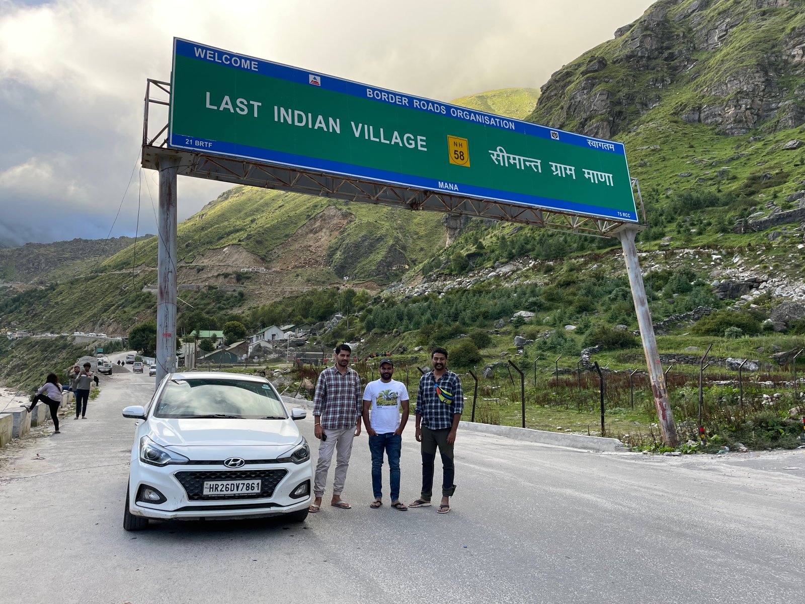
I do not think the experience depends on which slogan wins. Mana is a living village in Chamoli district, close to a sensitive international border. Uttarakhand Tourism places it around 3 km from Badrinath and about 3,219 metres above sea level.
Follow every security sign and local instruction. The visitor route through Mana is not permission to drive or walk farther towards the border.
Walking through Mana
The road brought us to the village, but the interesting part began on foot. Stone houses, small shops and narrow uphill passages sit close together, with high slopes rising around them.
Walk slowly. The elevation makes a short climb feel harder, especially just after arriving from lower ground. I would keep the first hour easy and stop whenever breathing becomes uncomfortable.
This is somebody’s home, not a heritage set. Ask before photographing residents, stay out of private courtyards and avoid blocking the lane while posing beneath a sign.
The Saraswati gorge near Bheem Pul
Bheem Pul is a large natural rock spanning the Saraswati River near the upper side of Mana. Local belief connects the boulder with Bhima from the Mahabharata. The Shri Badarinath Kedarnath Temple Committee identifies it as a recognised site around 3 km from Badrinath.
What stayed with me was the narrow, deeply cut rock and the force of the water below. From above, the gorge looked severe rather than peaceful.
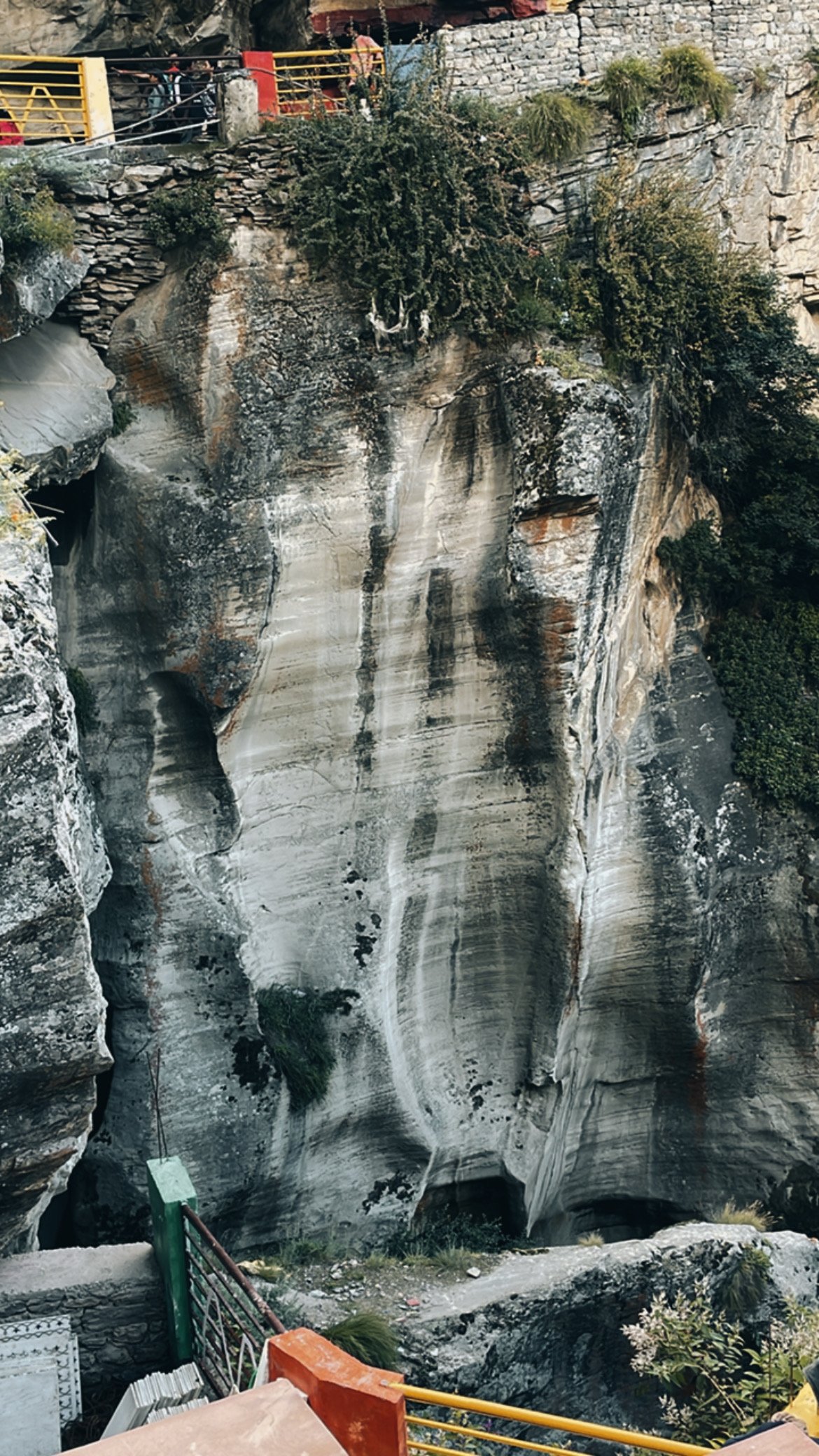
Use the marked path and railings. Do not lean over for a photograph or climb onto wet rock. The current and drop leave no room for a careless step.
Vyas Gufa and Ganesh Gufa
Vyas Gufa and Ganesh Gufa are associated with the traditional account of the Mahabharata being composed by Sage Vyasa and written by Lord Ganesha. They are religious sites, so describe the connection as belief rather than presenting it as a proven historical event.
Both caves are within the Mana area and can be included in the same village walk if they are open. Check locally, remove footwear where instructed and keep the visit quiet. Photography rules may differ inside.
I would not rush through them just to reach Bheem Pul. The lanes are steep enough that a slower sequence makes more sense.
I stopped for momos
My food memory from Mana is simple: a plate of steamed momos with bright red chutney. I photographed them before eating, which is the only specific meal detail I can verify from this visit.
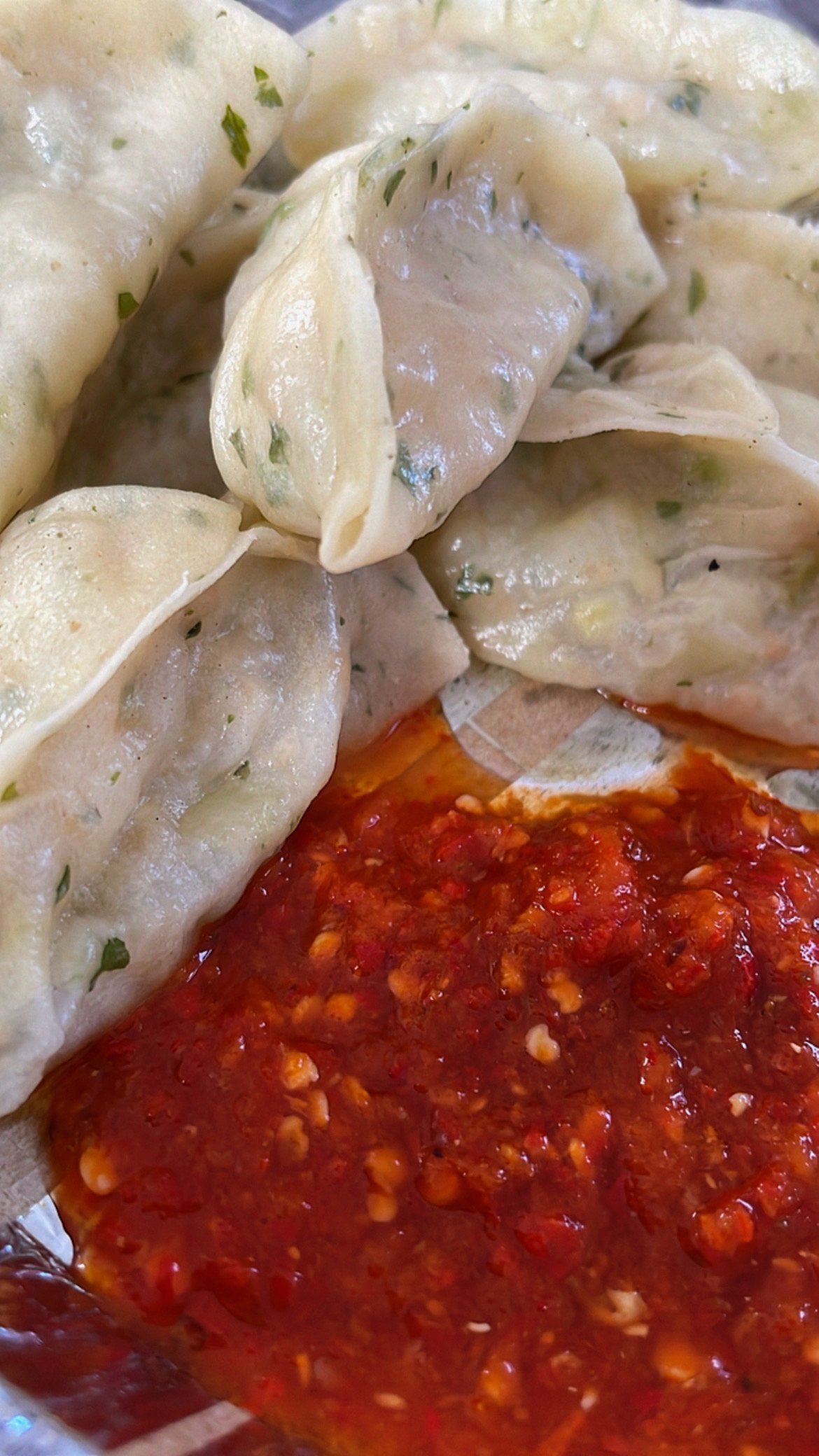
I do not have the price or shop name recorded, so I will not guess. Small eateries change with the season, and menus depend on supplies reaching the village.
Eat when you find a clean, busy place rather than waiting for a particular viral stall. Keep some water and a snack in the car, especially if the road is slow.
The “last shop” photograph
One of the shops I saw used a Hindi sign presenting itself as Hindustan’s last shop. It made an easy photograph, and several businesses in border destinations use similar claims.
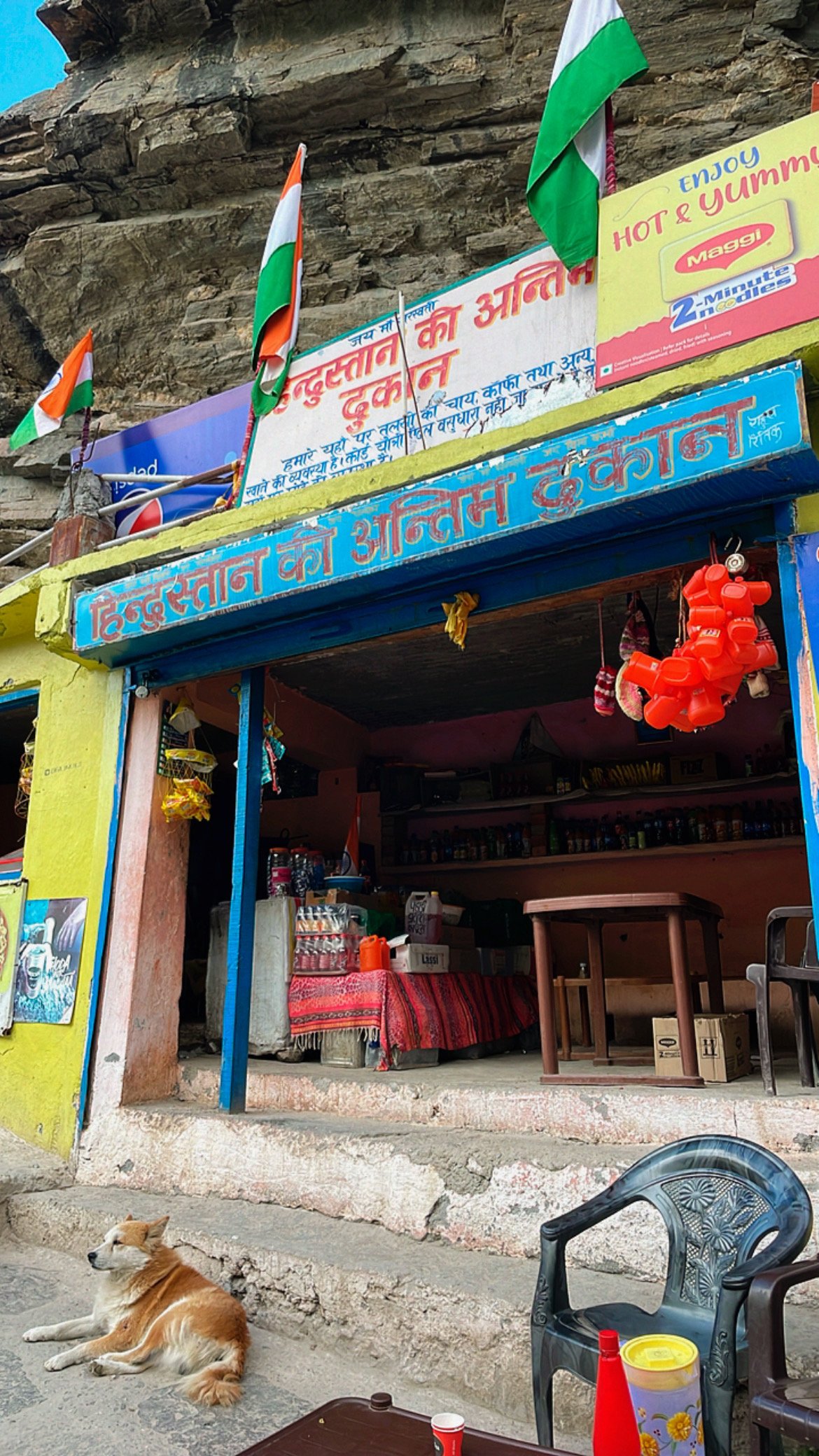
Treat that wording as the shop’s sign, not an independently verified title. Have tea or food if you want it, but do not choose a place solely because a board makes a superlative claim.
How to reach Mana
Mana is reached by road through Badrinath. The wider route climbs from Rishikesh through the Garhwal towns towards Joshimath and Badrinath before continuing the short final distance to the village.
This is a long mountain journey. Landslides, pilgrimage traffic, roadwork and weather can add hours. Break the route into sensible stages and avoid forcing the last section after dark.
The nearest practical railhead and airport are far away in the lower hills, so the final journey is always by road. Buses, shared vehicles and taxis operate on the Badrinath route during the pilgrimage season, subject to conditions.
Registration and vehicle documents
The official Badrinath Kedarnath Temple Committee directs pilgrims to complete the required Char Dham formalities before starting the yatra. Vehicle permits, green cards or trip cards may also apply depending on the current system.
Use the official Tourist Care Uttarakhand portal rather than paying an unknown agent through a social-media link. Carry identification and keep an offline copy of registration details because the mobile network may fail.
Requirements can change during the season. Check them again just before departure, even if you completed the same journey in an earlier year.
The best months for Mana
Official tourism and temple sources recommend May, June, September and October. These months generally align with Badrinath access while avoiding the strongest part of the monsoon.
July and August can bring heavy rain, landslides and road disruption. I visited in August and reached the village, but one successful trip does not prove the route will be safe on another monsoon day.
Winter snow usually cuts off ordinary visitor access. Do not plan a winter drive simply because an old map listing says the village is open.
Vasudhara Falls is a separate walk
Vasudhara Falls lies about 5 km beyond Mana, according to the Chamoli district administration. That makes it a proper high-altitude walk, not a quick extension to the village lane.
Attempt it only if the route is open, weather is stable and everyone in the group is comfortable at altitude. Start early, carry water and use a local guide when conditions or route knowledge are uncertain.
I do not have evidence that I completed the Vasudhara walk on this trip, so I am not presenting it as my experience.
Altitude can change the plan
At roughly 3,219 metres, Mana is high enough for visitors to feel headache, tiredness or breathlessness. Arrive gradually where possible, drink water and avoid a hard uphill walk immediately after getting out of the car.
Severe headache, vomiting, confusion, unusual breathlessness or poor coordination need medical attention. Descend when advised. Do not hide symptoms to protect the itinerary.
Cold can arrive quickly after cloud cover or sunset. Carry a warm layer and rain protection even if Badrinath feels sunny when you leave.
Is Mana a day trip from Badrinath?
Yes. The village, caves, Bheem Pul and a food stop can fit into several hours from Badrinath if the route and parking are moving normally.
I would not combine that walk with Vasudhara Falls unless the group has enough time, fitness and daylight. Nor would I race back to meet a tightly scheduled temple slot.
Stay flexible. A police hold, rain shower or traffic queue can change the order without warning.
Where should you stay?
Badrinath has more guesthouses, hotels and dharamshalas than Mana, and the temple committee lists accommodation in Badrinath and Joshimath. Mana may have seasonal local options, but availability changes.
I do not have a verified hotel record from this visit, so I will not recommend a property. Ask about parking, heating, hot water, meals and cancellation terms before paying.
Staying in Joshimath lowers the sleeping altitude but adds road time. Staying near Badrinath makes the Mana visit easier. Choose based on health, road status and the next day’s plan.
What I would do on another visit
I would return with fewer stops on the same day. Mana is small, yet the altitude, lanes and river deserve more attention than a quick signboard photograph.
I would walk to Bheem Pul, sit for tea, eat something warm and leave before the afternoon weather changed. If the road authority advised an early departure, that would decide the day.
Official planning links and related guides
Use the official Uttarakhand Tourism Mana guide for destination context, the Shri Badarinath Kedarnath Temple Committee for current pilgrimage information and the Tourist Care Uttarakhand portal for registration.
For other mountain journeys, read my Rishikesh weekend guide, Sissu snowfall guide and Chitkul travel guide.